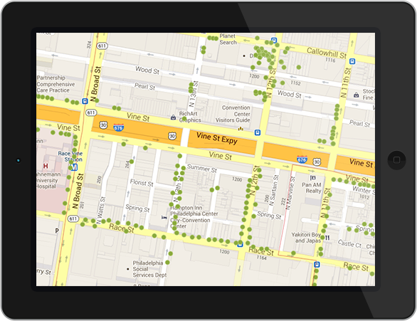
Mapping is the heart of OpenTreeMap
Your tree map enables users to search for trees based on location, species, size, date planted,
stewardship tasks, and other characteristics.
A detail page for each tree displays species, diameter and other data about the tree, images,
ecosystem services info, a map of the tree’s location, and a comments section.
Citizen foresters can lend a hand
Members of the community can
contribute to the creation of an accurate tree inventory by using a user-friendly map interface
to add tree records, update existing tree information, upload photos of local trees, and enter
stewardship activities. A link to a tree key lets users identify tree species, while you can
review all edits through your administrative dashboard.

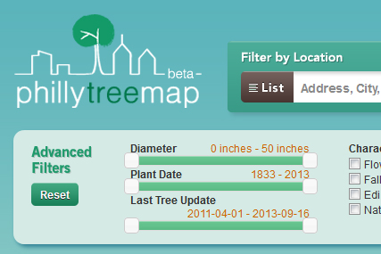
Customize the system you want
With customizable public access and management options, your tree map is unlike anyone
else’s. Decide to make your inventory public or not. Choose whether or not to allow the
public to update tree data. It’s all up to you. Search options, maps, stewardship
activities, and data fields are all customizable by you, not us.
Need to track pests, survey or collection dates, or specific projects? Adjust the information
fields and search options to match your data needs. Optional features include public
commenting, read-only trees, and a pending edits system.
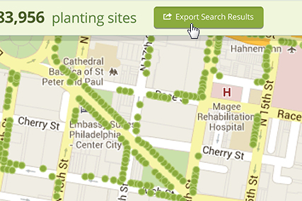
Export the data you need
Export tree data for use in your other systems. Share with colleagues or perform more
in-depth analyses of your inventory outside of OpenTreeMap.
Only need OpenTreeMap to conduct a quick tree inventory? Not a problem: OpenTreeMap
subscriptions are month to month with no obligation. Just map your trees, export it all when
you’re finished, and you’re done!
Save resources by partnering with other agencies
Local government, non-profits, and community development groups all care for urban trees.
Save resources by sharing an OpenTreeMap account with others.
Your tree map can be used by multiple organizations to compare inventories and share data as
you wish. Bulk data upload options are available and system checks reduce duplicate tree
entries. OpenTreeMap’s affordable tiered subscription model
can accommodate everything from very small inventories to large metropolitan areas with an
unlimited number of users.
Seamlessly integrate your tree map with other systems
Our developers are currently working on APIs that will enable you to integrate your existing
systems with OpenTreeMap. You will no longer need to move your inventory in and out of
separate GIS or works management systems in order to complete all your tasks.
Send us an email at [email protected]
so we can let you know when this feature is ready.